The Ground Control Station (GCS) is a software application used to establish a connection to the vehicle. The software allows the user to adjust vehicle parameters and receive real time data during the vehicle's flight. Although each software is unique, it generally provides the user with a virtual cockpit and a live map that indicates the vehicle's position. For the vehicle's designed in this project the GCS also provides the user with options for pre-planned autonomous flights and provides a two-way communication to control the vehicle during flight. For more background information reference GCS comparison.
Why Mission Planner?
Although there are different versions of ground control stations, Mission Planner is used within the documentation of this project due to the open source licensing, range of features, and easy integration. Mission Planner allows predetermined flight plan control and provides the ability to control the vehicle during flight. A simulated live cockpit and real-time google map integration provides vehicle information during flight. For a full background of the software and complete documentation reference Mission Planner Home. While Mission Planner continues to be a useful recourse, the team is examining transitioning the project to Q-Ground Control.

QGround Control
QGround Control provides a modern GCS interface with similar functionality to Mission Planner. While the software was originally designed for PX-4 it now supports ArduCopter (the software used for this project). In addition to the clean interface, QGround Control also provides a mobile app that can be used with a phone or tablet. As the UAV-RT system continues to develop the team is examining moving the system towards QGround Control, in favor of the modern design and easy user interface. For more information regarding QGrond Control and the download link, reference the main documentation.
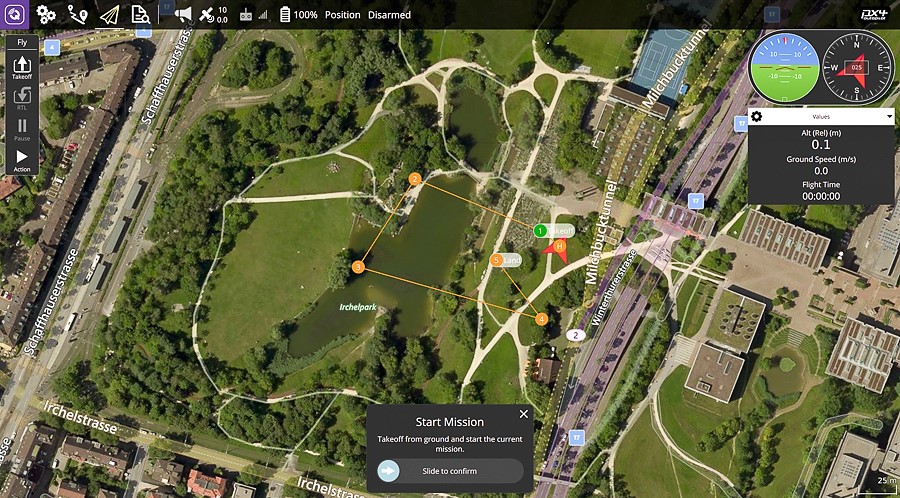
Flight Modes vs Flight Plans
When operating the vehicle and programming autonomous flights for the vehicle, it is helpful to distinguish between flight modes and flight plans. To build flight plans specific to tag localization reference Using Mission Planner.
| Flight Modes | Flight Plans |
| Determines flight behavior of copter and extent of operator control | Applicable in the auto flight mode |
| Over 20 built in flight modes | Pre-determined before takeoff and pre-loaded onto copter |
| Can be switched during flight | Generated with GCS user interface using interactive map |
Flight modes are different built in modes of operation that determine how the vehicle will fly. For example, the flight mode stabilize will allow you to move the drone's location and altitude but once the pilot stops inputting direction commands the flight controller on-board the vehicle will bring the vehicle back to a level/stable position. Other flight modes cause the vehicle to perform a specific action, like circle. When the vehicle is in a circle flight mode it will rotate around the current location at a predetermined radius (pointing the front of the vehicle towards the center of the circle). This flight mode is especially useful because if the radius is set to zero the the vehicle will simply rotate in place. For a complete list of flight modes reference Flight Modes.
Flight Plans are used to create pre-determined missions for the vehicle to fly autonomously. Using the interface in Mission Planner flight plans can be created that will direct the drone to fly to various locations. Within these flight plans the user can dictate altitude and direct the vehicle to perform various flight modes. For instructions on how to build tag localization flight plans reference Using Mission Planner. For complete instruction on creating autonomous missions use Arducopter's documentation.
Below is a link to a presentation given on the Arducopter Flight Controller and Ground Station Software. The presentation gives an overview of commonly used flight modes, the differences between flight modes and flight plans, and the how these features are used in Mission Planner.